
If you use the Qbitec plugin for Autodesk® Revit® to work with point clouds and reality capture data, the January 2025 update brings a set of changes worth knowing about. Across five separate releases last month, the Qbitec plugin update introduced meaningful upgrades to rendering, navigation performance, and point cloud georeferencing — all aimed at making large-scale point cloud workflows inside Revit faster and more reliable. For BIM teams, architects, and engineers who regularly import laser scan or reality capture data into their projects, these refinements address some of the most common friction points in daily use.
Below is a closer look at what changed and why it matters for anyone working with point clouds in Revit.
Rendering Optimizations and Performance Improvements
One of the more practical changes in this Qbitec plugin update is how render settings are now handled. Previously, users had to manually reconfigure their display and render settings each time they reopened a project, which wasted time and often led to inconsistent visual results between sessions. With the new update, render settings are now saved per view within the project itself. That means each view retains exactly the configuration it had when last adjusted, removing the need to redo this setup repeatedly.
Alongside this, the plugin received several smaller but useful refinements. The default point size has been reduced, which improves visual clarity when reviewing dense scan data, especially in tighter architectural spaces. A bug that previously caused visible rendering artifacts in panorama images has also been fixed, resulting in cleaner, more accurate panoramic views for teams relying on 360-degree captures for site documentation.
Optimized Point Loading Strategy for Smoother Navigation
Anyone who has worked with very large point clouds knows that loading speed can make or break a workflow. In earlier versions of the plugin, panning or zooming through large datasets sometimes revealed incompletely loaded areas, forcing users to pause and wait for data to catch up — a frustrating interruption when trying to maintain design momentum.
The new point loading strategy addresses this directly. Rather than loading data reactively, the plugin now intelligently preloads predictable areas of the point cloud based on the direction and pace of navigation. The practical result is smoother, uninterrupted movement through the model, even with very large datasets that would previously have caused noticeable lag. For firms handling scan-to-BIM projects on large sites — such as industrial facilities, campuses, or infrastructure projects — this kind of performance gain translates directly into time saved during coordination and review meetings.
Georeferencing NavVis Ivion Point Clouds
Perhaps the most significant new capability in this update is the addition of georeferencing support for NavVis Ivion point clouds. Users can now place point clouds automatically using either the project’s site coordinate system or the geocoordinates already embedded in the point cloud data itself, rather than relying on manual alignment.
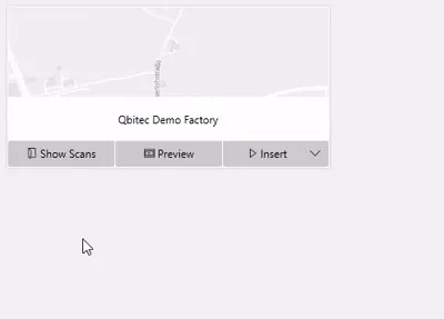
This feature is accessed through the “Insert” dropdown menu, making it a straightforward addition to existing workflows rather than a separate tool to learn. For teams managing large, geolocated point cloud datasets — particularly on projects spanning multiple buildings or sites — this removes a manual step that was previously prone to human error. Accurate georeferencing is especially valuable in infrastructure and urban planning projects, where even small placement discrepancies can compound across a large site.
Additional Fixes and Enhancements
Beyond the headline features, the January 2025 update includes a number of smaller but practical improvements:
- Improved trial experience: The onboarding process for trial users has been streamlined, making it easier for new users to evaluate the plugin without friction.
- Renamed “Tomo” render mode: This mode is now labeled “X-ray,” giving it a clearer, more intuitive name for users selecting render options.
- Consistent point sizes across multiple point clouds: A bug causing mismatched point sizes when inserting several point clouds into the same project has been resolved.
- More robust E57 file conversion: The plugin now handles E57 files with faulty or incomplete metadata more gracefully, reducing failed imports.
These changes reflect an ongoing effort to smooth out the day-to-day details that affect how efficiently teams can work with reality capture data inside Revit.
Final Thoughts
Taken together, the improvements rolled out in this Qbitec plugin update — from per-view render settings and smarter point loading to automatic georeferencing for NavVis Ivion data — are focused on reducing repetitive manual work and improving performance for users managing large, complex point cloud datasets. For teams that rely on accurate, well-organized reality capture data in their BIM workflows, these updates should translate into fewer workarounds and a more consistent experience across projects.
If you use the Qbitec plugin as part of your Revit workflow, it’s worth updating to take advantage of these changes, particularly the georeferencing feature if your projects involve NavVis Ivion scans. You can get the latest version directly from Qbitec’s official download page to start using these improvements right away.